|
Prosurv Imaging with Pocket Quads.NET
7.5' USGS Topo Quad Sheet Software for your
PC
|
Prosurv Imaging Version 2.2* |
Download |
|
*This is not a full installation package.
Extract the contents of the zip file to the installation folder of
Prosurv Imaging (normally c:\Program Files\Prosurv
LLC\Prosurv_Imaging.exe) and replace the existing executable.
Then, add the following text to the
ImagingDefaults.txt file, located in the same folder:
TFWUnits=meters
Version 2.2 Uploaded 30 March 2005 |
|
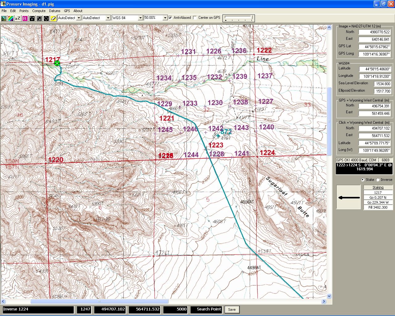
-
View virtually any geo-referenced .tif
image
-
Save single image for use with Pocket
Quads
-
Batch process multiple images for use
with Pocket Quads
-
Create & Open Job Files
-
Job Files are Independent of Image
-
Import NGS Datasheets (creates points)
-
Import .asc Points Files
-
Import GCDB (Government section corner
database files)
-
Export .asc Points Files
-
Create & Edit SETS (point lists)
-
Draw Lines, Text, Polygons, and more.
Lines and Text are stored with the Job
-
Hand enter points (coordinates) or
Latitude & Longitude
-
View Point List
-
Profile Points
-
Delete Points
-
Compute
-
Polygon Area
-
Divide Section into Aliquot Parts
-
Pre-determined Sliding Line Acreage
-
Pre-determined Hinged Acreage
-
Inverse Report
-
Translation & Rotation
-
Intersections
-
Set Default Image Datum (Image Datum
automatically set when available)
-
Set Default Job Datum, or individual Job
Datum. Job Datum lets you work in a different Datum than the Image
Datum, for example, work in Wyoming West Central State Plane Coordinates
(NAD83), even though the Image Datum is UTM 12 (NAD27)
-
Built-in On the Fly NADCON conversion
-
Real-time GPS tracking
-
Record points at time or distance
intervals
-
Stakeout (Navigate to) points
-
View your position on the Quad sheet as
you drive
-
Requires a GPS receiver with NMEA
output; may require the GPS manufacturer's serial port driver(s)
-
8 Command-Line coordinate geometry
(computation) functions
-
Work in Meters, US Foot, or International
Foot units
-
Included with Pocket Quads
Download
the Documentation*
*Right-click and select Save Target As to
save the documentation to your computer. Documentation is in Adobe
Acrobat .pdf format. The Adobe Acrobat Reader is required to view
the file. Visit www.adobe.com to
download the free reader.
Prosurv Imaging uses
GPSTools from franson.biz
for acquiring GPS Data. |